Resources Library

Resources Library

Bakul SeaSketch

The link to the Bakul Seasketch map; an interactive online map where participants can play around with different thematic layers.
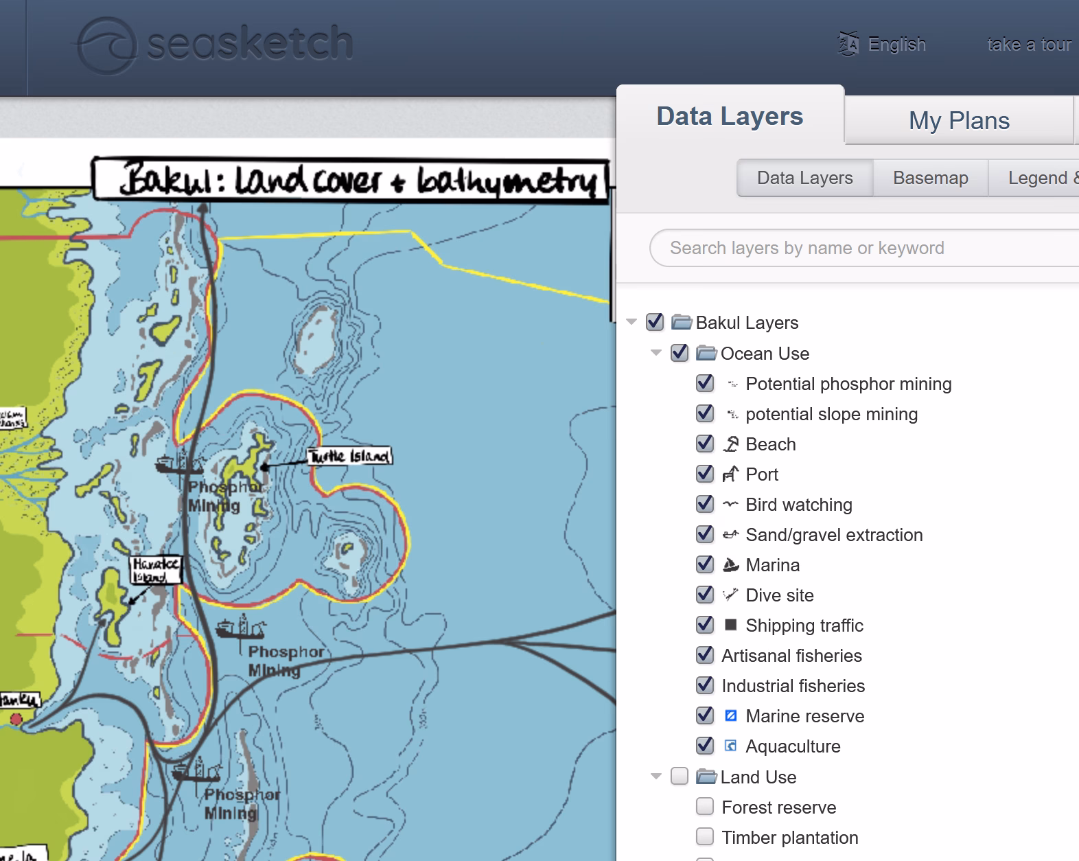
Here are the links to Bakul SeaSketch so participants can enjoy practical exercises on a virtual setting. SeaSketch allows participants to view different Basemaps of Bakul, and play around with different overlays: Ocean use, land use, erosion risk, and flood risk.

Related Resources to embark on your Journey:

The Leaflet of the Blue Capacity Hub explains what this initiative is about, what are the courses on offer and why choosing them. (High Resolution / Print version)
The Leaflet of the Blue Capacity Hub explains what this initiative is about, what are the courses on offer and why choosing them. (Low Resolution / Web version)
The Leaflet of the Blue Capacity Hub explains what this initiative is about, what are the courses on offer and why choosing them. (Screen Reader Compatible / Sliced version)
The Leaflet of the Blue Capacity Hub explains what this initiative is about, what are the courses on offer and why choosing them. (High Resolution / Print version)
The Leaflet of the Blue Capacity Hub explains what this initiative is about, what are the courses on offer and why choosing them. (Low Resolution / Web version)